
Active Projects

Clarion River Access Management Plan
USGallery
Details
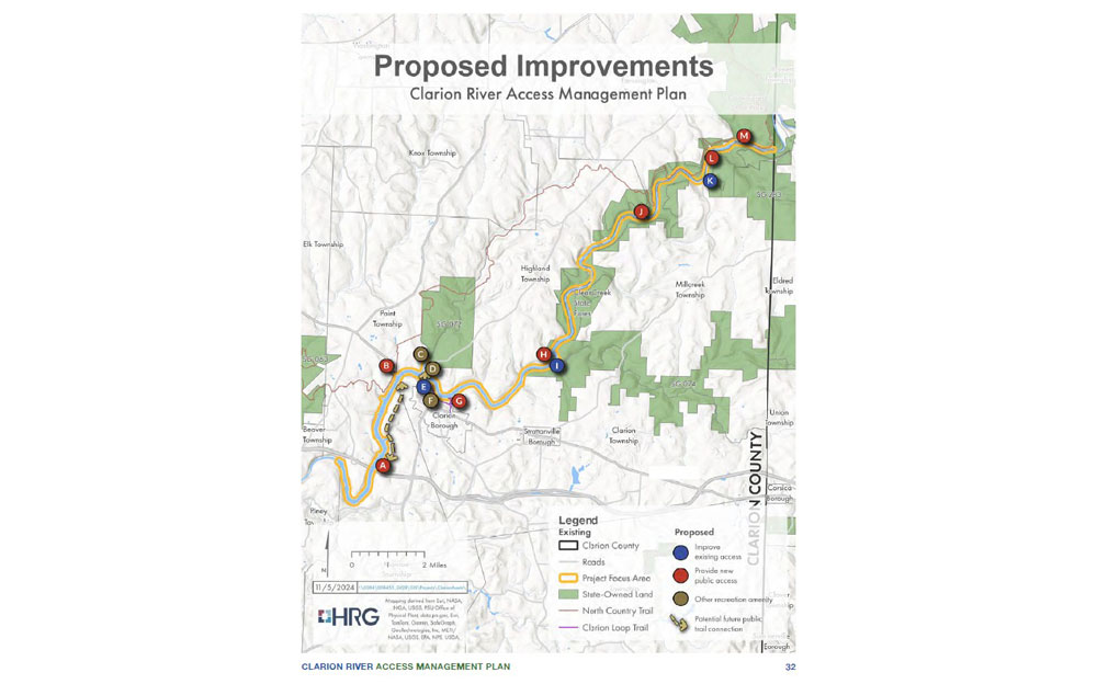
The Clarion River Access Management Plan provides a roadmap for enhancing public access, recreation, and tourism along a 23.5-mile segment of the Clarion River between Piney Dam and Cooksburg.
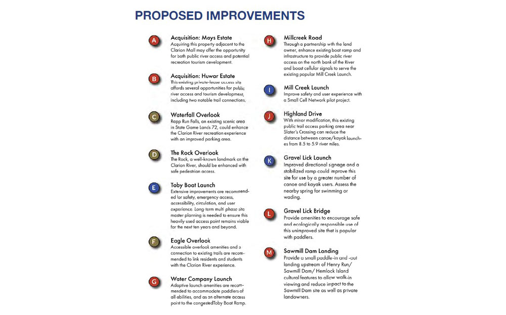
Developed through extensive public engagement and stakeholder input, the plan identifies opportunities to improve existing river access points, establish new access locations, strengthen connections to nearby recreational and cultural assets, and enhance accessibility for users of all ages and abilities. Key recommendations include improvements to the Toby Boat Launch, Mill Creek Launch, and Gravel Lick Launch, as well as the development of new destinations such as Eagle Overlook and other strategic river access sites. The plan aims to position the Clarion River as a premier outdoor recreation asset while balancing environmental stewardship, habitat protection, and sustainable tourism development.
Community Workshops:
Community engagement was a cornerstone of the Clarion River Access Management Plan. The planning process included a steering committee of local stakeholders, meetings with property owners and agency partners, key stakeholder workshops, and a public survey that generated 234 responses. Through mapping exercises, public feedback, and collaborative discussions, residents and stakeholders helped identify priorities for improving river access, enhancing recreational opportunities, and strengthening connections between the Clarion River and surrounding communities.